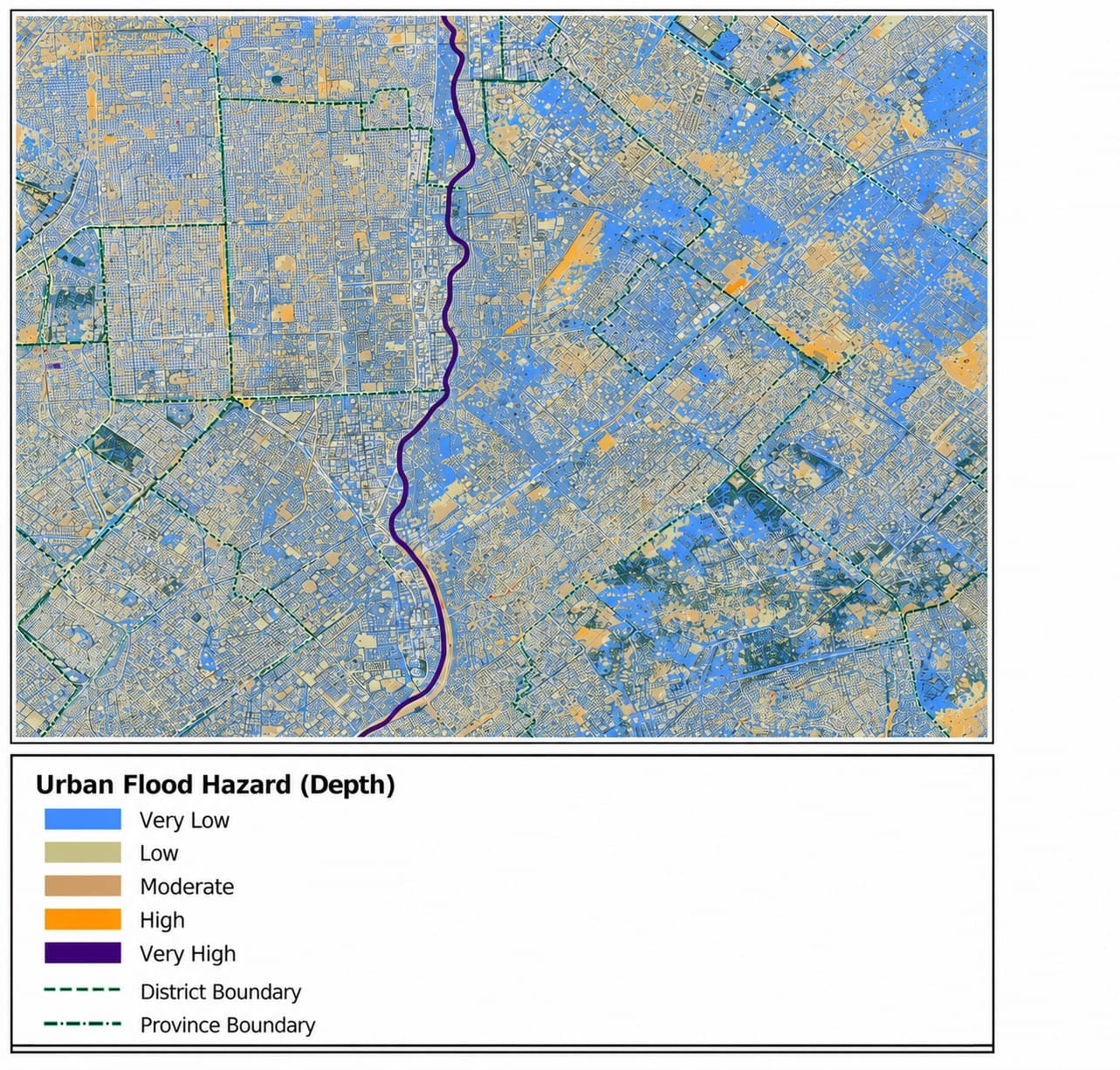
A mixed residential and commercial district of Karachi floods repeatedly where a watercourse runs directly through dense built-up area, and the metropolitan disaster management authority had no depth-classified hazard map to ground its flood-risk planning for the corridor — only a general awareness of which blocks flooded worst in past events.
GeoVeris simulated event-based urban flood hazard in openLISEM, a physically-based spatially distributed model, over a DEM of the district, classifying simulated inundation depth into five hazard tiers from Very Low to Very High across both the watercourse corridor and the surrounding built-up area.
The resulting map showed the Very High hazard class concentrated tightly along the main watercourse — consistent with direct channel and floodplain inundation — while Low and Moderate hazard spread far more widely across the surrounding district, reflecting the shallow, drainage-driven ponding typical of urban flooding away from the channel itself.
The hazard map was delivered for the authority's district-level flood-risk planning, with an exposure-weighted risk layer — combining this depth classification with population and asset density — flagged as the natural next phase.
Methodology
Simulated event-based urban flood hazard in openLISEM, a physically-based spatially distributed model that routes rainfall-runoff and channel flow over a DEM at event scale. Classified simulated inundation depth across the district into five hazard tiers (Very Low to Very High) to distinguish direct channel/floodplain flooding from the shallow, widespread ponding typical of overwhelmed urban drainage away from the watercourse.
Results & Outcomes
- Classified simulated flood hazard into five depth tiers (Very Low to Very High) across the modeled district
- Found the Very High hazard class concentrated tightly along the main watercourse, consistent with direct channel and floodplain inundation
- Mapped low-to-moderate hazard spreading widely across the surrounding built-up area from shallow, drainage-driven ponding
- Delivered district- and province-boundary-referenced hazard maps directly usable in the authority's flood-risk planning process
Challenges
Depth-only hazard classification tells a planner where water will pool but not who or what is exposed to it, so the map's Very High class along the watercourse and its widespread Low/Moderate class across the built-up area needed to be read alongside population and asset density separately rather than as a single combined risk score. That gap was flagged directly to the authority as the natural next phase — an exposure-weighted risk layer built on top of the current depth classification.