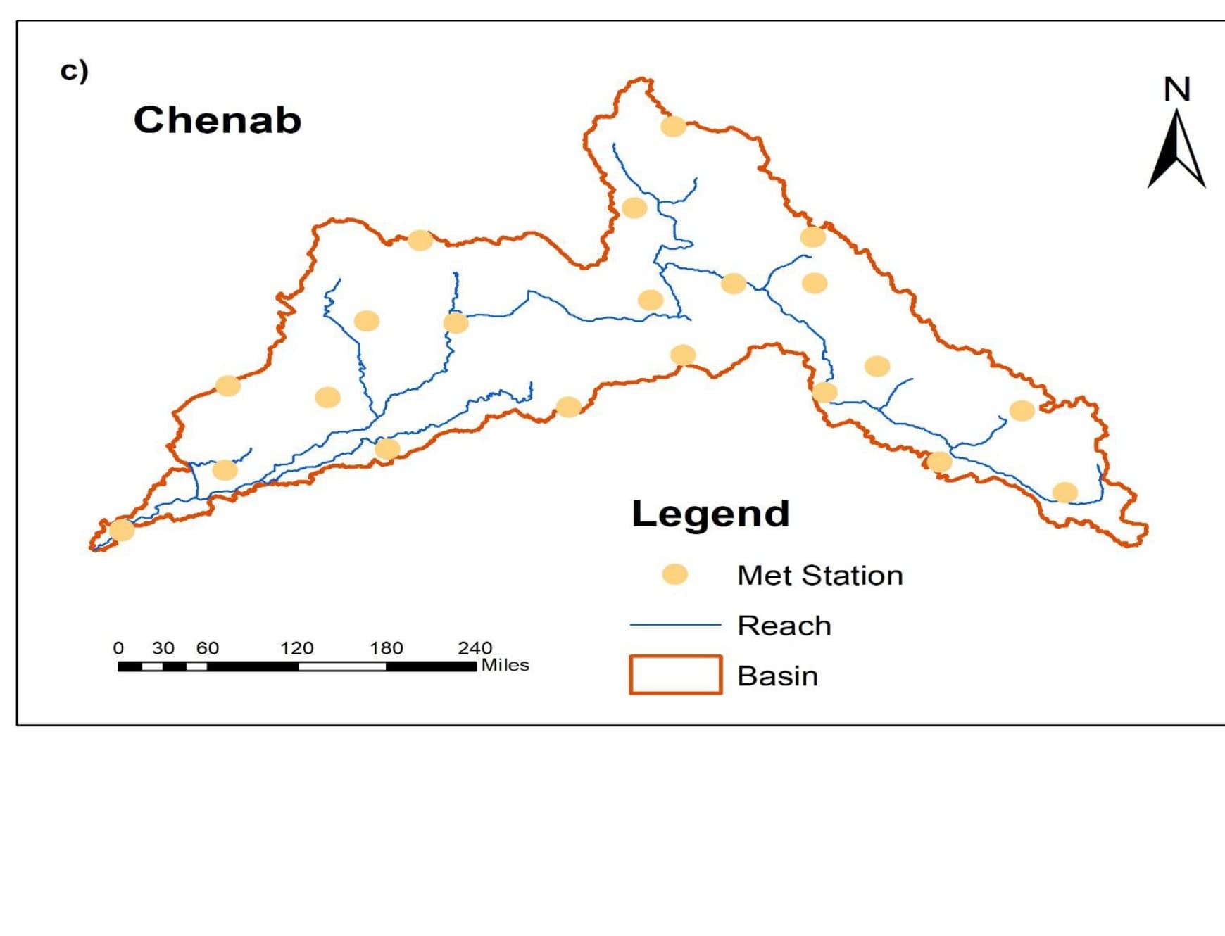
The Chenab originates in the Himalayas and flows freely to Marala with no dam or headwork regulating it upstream — a trans-boundary basin whose runoff behavior the water authority needed to understand quantitatively before it could plan inflow forecasting or reservoir-operations work, but for which no calibrated basin-scale model existed.
GeoVeris built a semi-distributed SWAT model of the 26,035 mi² basin, delineating it into 23 sub-basins from a 90 m SRTM DEM and defining hydrological response units from global land-cover, harmonized soil, and slope data. The model was driven by ERA-Interim climate data at 21 stations and calibrated against 1985-1999 observed monthly discharge at Marala using SWAT-CUP's SUFI-2 algorithm across 11 sensitive parameters, then validated against an independent 2000-2010 period.
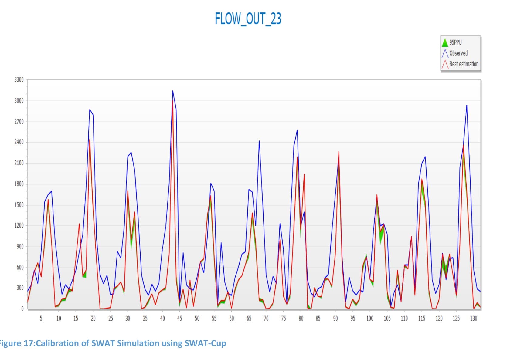
The calibrated model reproduced observed flow with an R² of 0.58 and NSE of 0.40 in calibration, and 0.52 and 0.32 in validation — both within accepted ranges for monthly streamflow — while a positive PBIAS in both periods showed the model consistently underestimates the basin's sharpest peak flows, a bias the authority now has clearly quantified rather than hidden inside an unvalidated forecast.
The calibrated model is now the authority's starting point for inflow forecasting and future climate-scenario testing on the basin.
Methodology
Built a semi-distributed SWAT model of the 26,035 mi² Chenab basin, delineated into 23 sub-basins from a 90 m SRTM DEM, with hydrological response units defined from global land-cover, Harmonized World Soil Database soil classes, and reclassified slope. Drove the model with temperature and precipitation extracted from ERA-Interim at 21 stations (1979-2018) and calibrated/validated monthly simulated flow against observed discharge at Marala (WAPDA, 1979-2010) using SWAT-CUP's SUFI-2 algorithm across 11 sensitive parameters, including curve number (CN2), groundwater delay, and base-flow alpha factor.
Results & Outcomes
- Delineated the 26,035 mi² basin into 23 sub-basins and calibrated the model against 1985-1999 observed flow (R² = 0.58, NSE = 0.40)
- Validated against an independent 2000-2010 period (R² = 0.52, NSE = 0.32), confirming the model transfers beyond calibration
- Identified a consistent underestimation bias (PBIAS +37.8% calibration, +33.4% validation) at high flows
- Delivered a calibrated basin model usable as the foundation for inflow forecasting and climate-scenario testing
Challenges
SWAT's more than 39 hydrological parameters made blind calibration impractical, so sensitivity analysis was used first to narrow the search to the 11 parameters that actually moved simulated flow. Even after calibration, the model consistently underestimated the basin's sharpest peak flows — a bias attributable in part to relying on a coarse global reanalysis (ERA-Interim) for precipitation rather than denser station observations, which the model's positive PBIAS score makes explicit rather than hides.