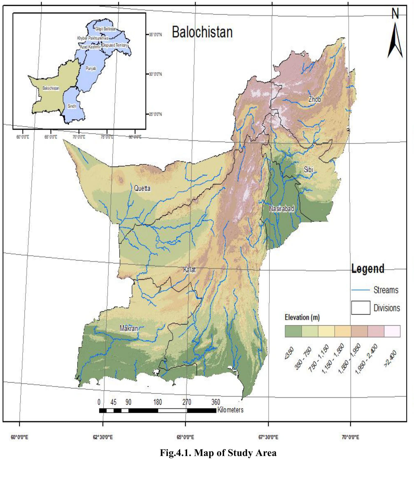
Balochistan is Pakistan's largest and most drought-prone province, but the provincial department responsible for water and agriculture planning had never had a single, defensible, province-wide picture of drought severity — assessments of vegetation stress, rainfall deficit, and streamflow drought had always lived in separate silos, none of them looking ahead to how climate change might shift the picture.
GeoVeris combined MODIS vegetation and temperature data, FLDAS soil moisture, PMD station records, and ERA5-Land climate data in Google Earth Engine to compute five drought indices — VCI, TCI, SMCI, SPI, and SDI — across Balochistan's six divisions for 2000-2015, then projected meteorological and hydrological drought through 2050 under two CMIP6 emissions scenarios.
Cross-referencing all five indices gave the department its first unified severity ranking: every division showed drought somewhere in the record, but with markedly different frequency and intensity, and the future projections showed drought frequency consistently higher under the moderate SSP245 scenario than under high-emissions SSP585.
The division-by-division severity ranking and future projections are now feeding directly into the department's water-resource and drought-monitoring planning.
Methodology
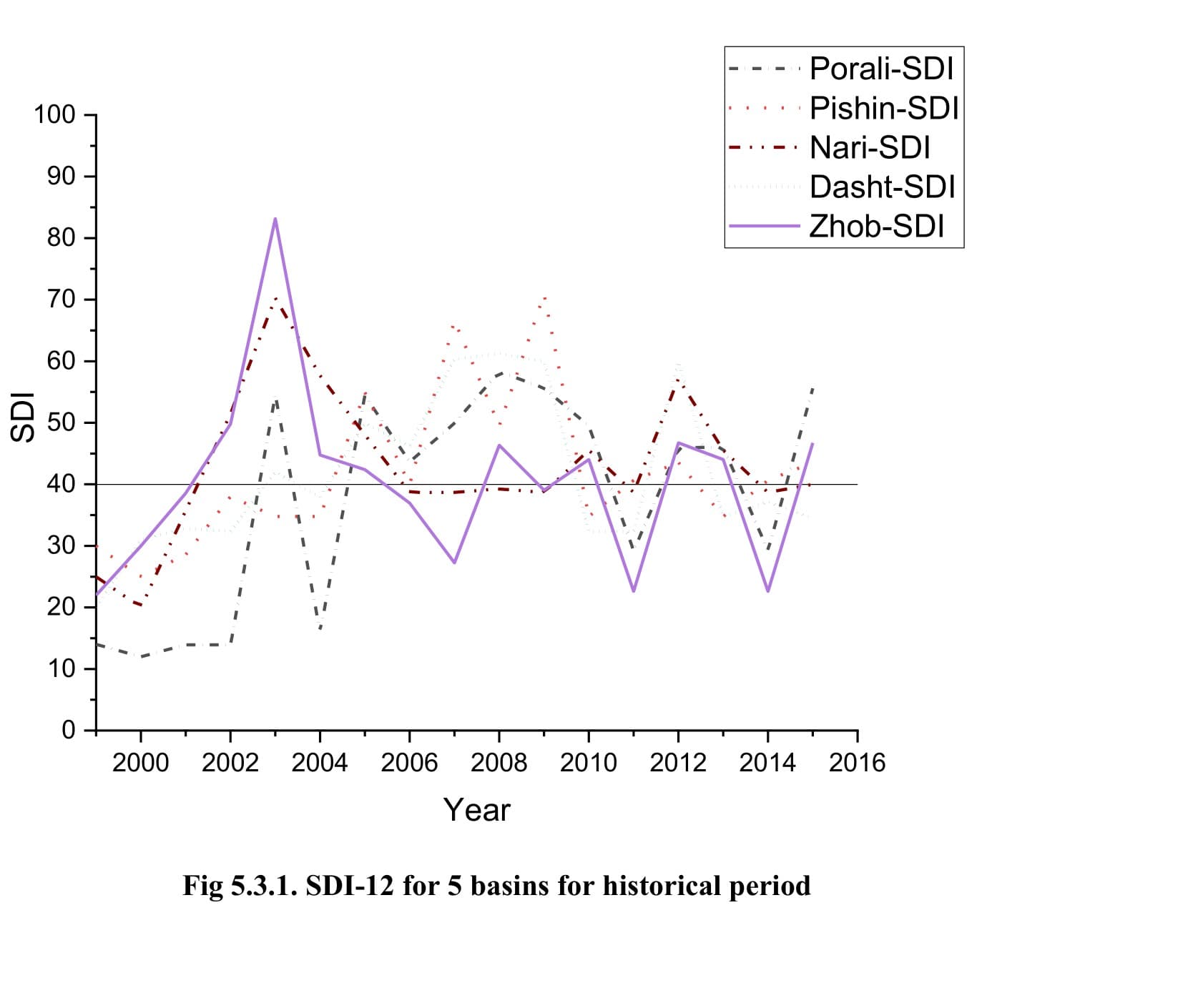
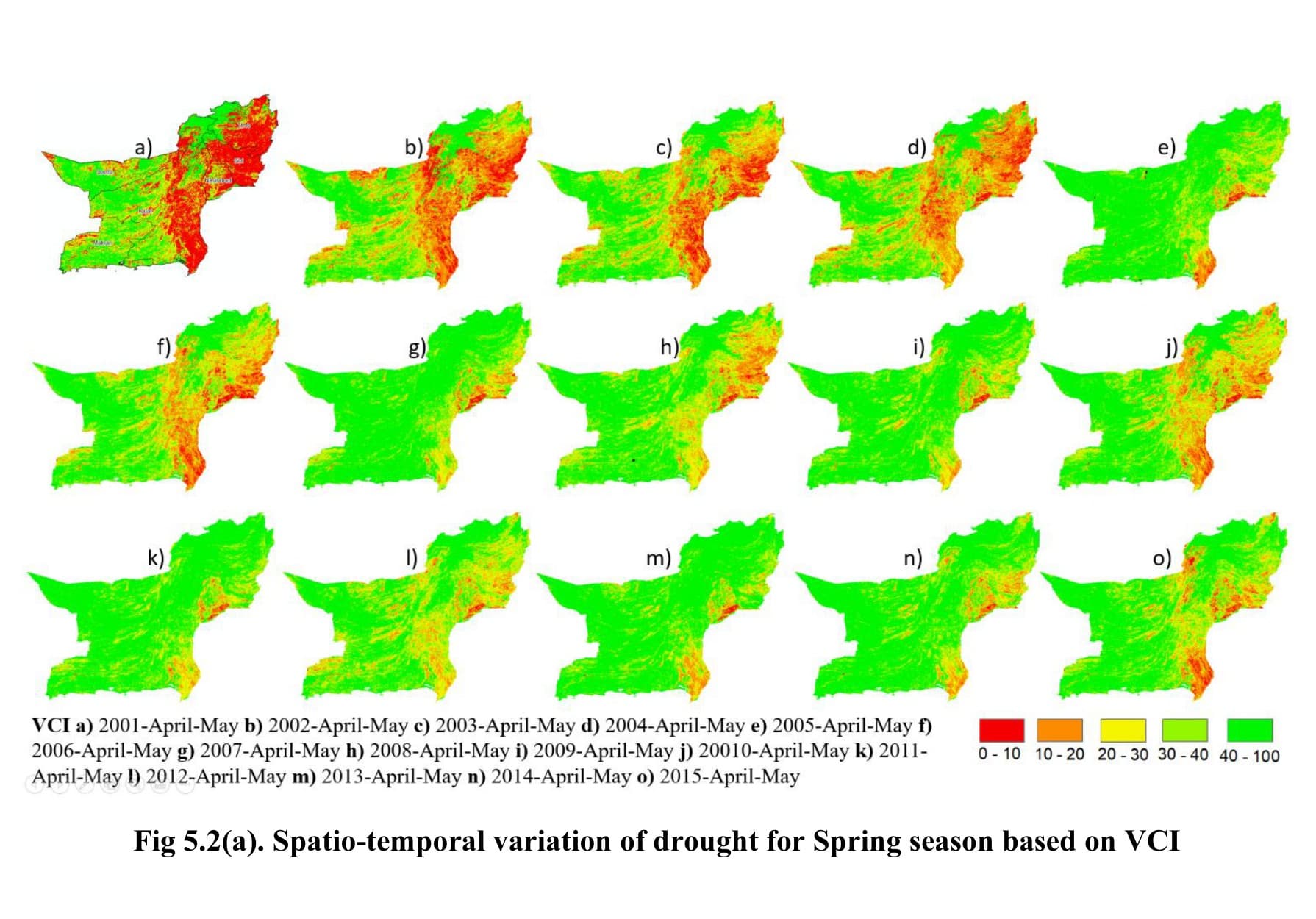
Combined MODIS NDVI (MOD13Q1) and LST (MOD11A2), FLDAS soil moisture, PMD station records, and ERA5-Land climate data in Google Earth Engine to compute Vegetation, Temperature, and Soil Moisture Condition Indices (VCI, TCI, SMCI) and the Standardized Precipitation Index (SPI-6, SPI-9) across Balochistan's six divisions for the 2000-2015 historical period. Computed the Streamflow Drought Index (SDI-12) for five major basins from WAPDA discharge records, then projected future meteorological and hydrological drought through 2050 using an ensemble of five CMIP6 GCMs under the SSP245 and SSP585 scenarios.
Results & Outcomes
- Quantified drought severity (severe to light) across all six divisions using five independent indices
- Identified Zhob as the division with the most frequent drought episodes and Nasirabad with the fewest
- Found no extreme meteorological drought (SPI) in Makran across the 2000-2015 historical record
- Projected higher future drought frequency under SSP245 than SSP585 across most divisions through 2050
Challenges
Reconciling five drought indices built from different sensors and time steps — 16-day NDVI composites, monthly soil moisture, daily station precipitation, monthly streamflow — into one coherent province-wide picture meant standardizing every index onto the same 0-100 severity scale before any cross-index comparison was possible. Spring and autumn vegetation- and soil-moisture-based indices also diverged in several divisions, which required examining the two seasons separately rather than presenting a single annual figure.